
Objective - Actionable Data | Informed Decision Making | Budget Control.
At Tailored Drone Solutions, we don’t just fly drones, we deliver the actionable data that keeps your projects on schedule and within budget. Whether you manage construction sites, coordinate C&I solar installations, or ensure functionality, safety and efficiency through FM, we provide the clarity you need to make confident real time decisions.
The drone flight is only the first step. We convert aerial imagery into accurate maps, 3D models and visual reports which can be integrated into your workflow.
Resulting in reduced site visits, safer remote inspections, robust cost control, protection of margins, early detection of maintenance needs, the advantage during dispute resolution, improved sales ratios and much more.
Tailored Solutions for Your Industry
We understand that every sector faces unique challenges. Our aerial data services are designed to deliver immediate, measurable results, saving you time, money and energy!
Commercial | Industrial Solar Installation
Challenge: While satellite imagery is easy to access, it often lacks the resolution and accuracy needed for detailed solar project planning, especially when identifying roof obstructions, shading issues, or precise panel placement. Inaccurate data at the start can lead to costly redesigns, installation delays, reduced system performance and even the loss of sales.
Solution: We capture real time accurate aerial imagery tailored to your exact needs. This allows for precise measurement, accurate shading analysis, and early detection of potential issues before installation begins. The result? Professional surveys, optimised layouts, reduced on site surprises, and a more confident client decision leading to increased sales. See our dedicated C&I Solar page for more examples of common challenges faced and the solutions we provide.
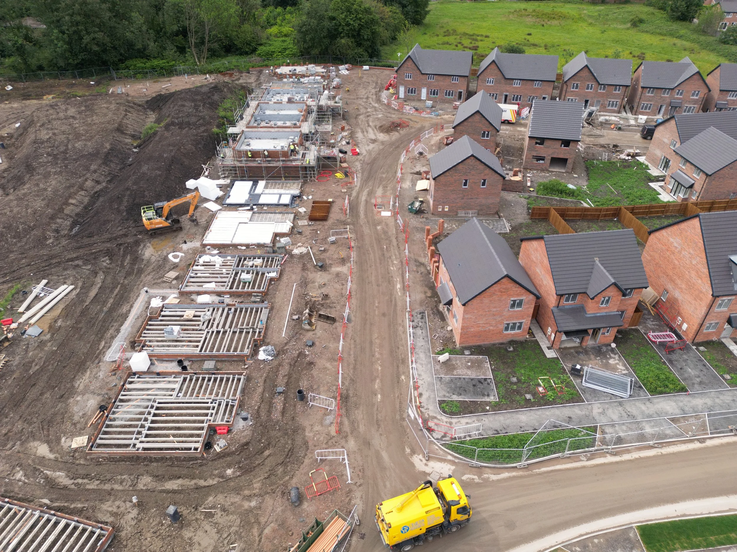
Construction | Housebuilding
Challenge: Tracking progress and variations, sub-contractor management, dispute resolution and claims will drive up costs eroding a projects profit margins.
Solution: Our precise maps and 3D models integrate seamlessly into your workflow, enabling accurate progress tracking, robust defence of variations and disputes and reduced reworks, keeping projects on programme and budgets intact. See our dedicated Construction page for more examples of common challenges faced and the solutions we provide.
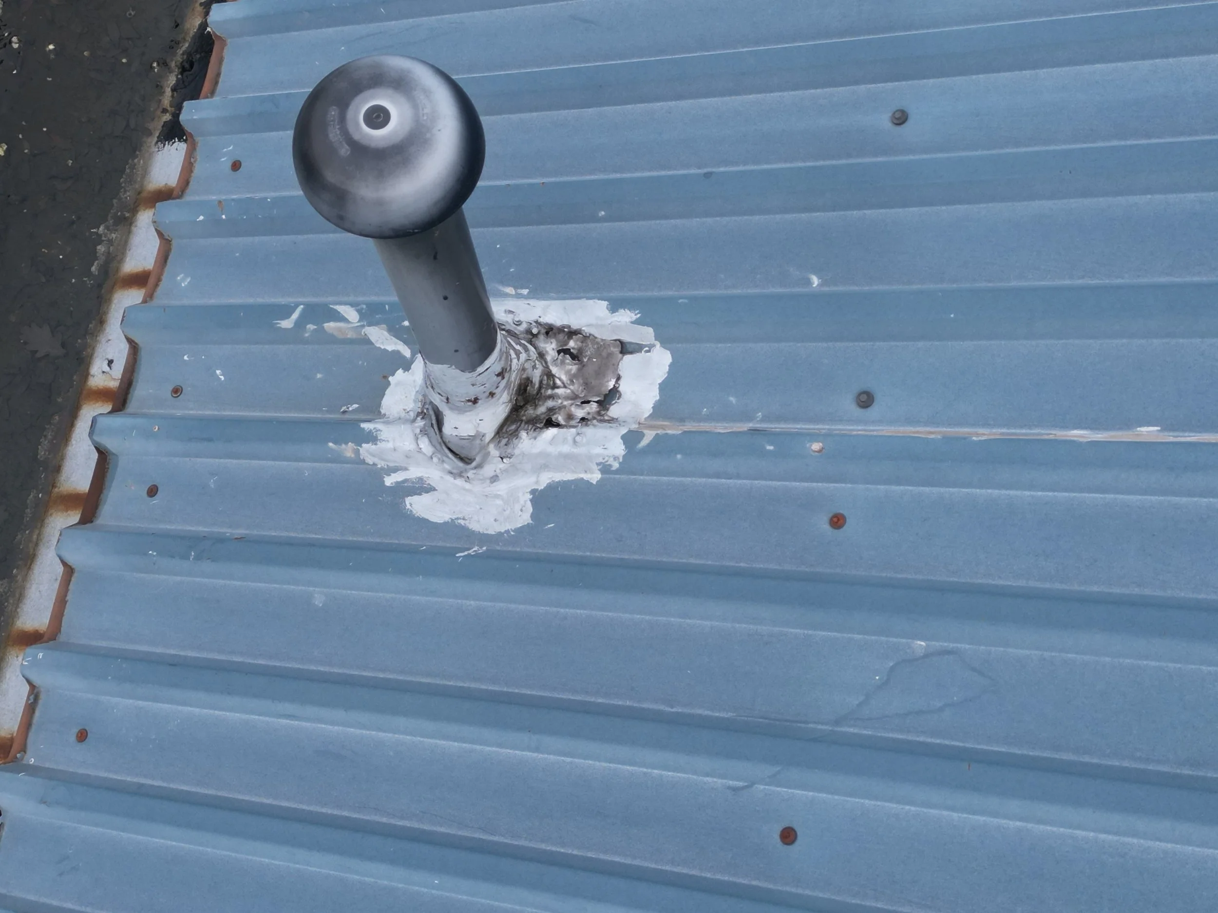
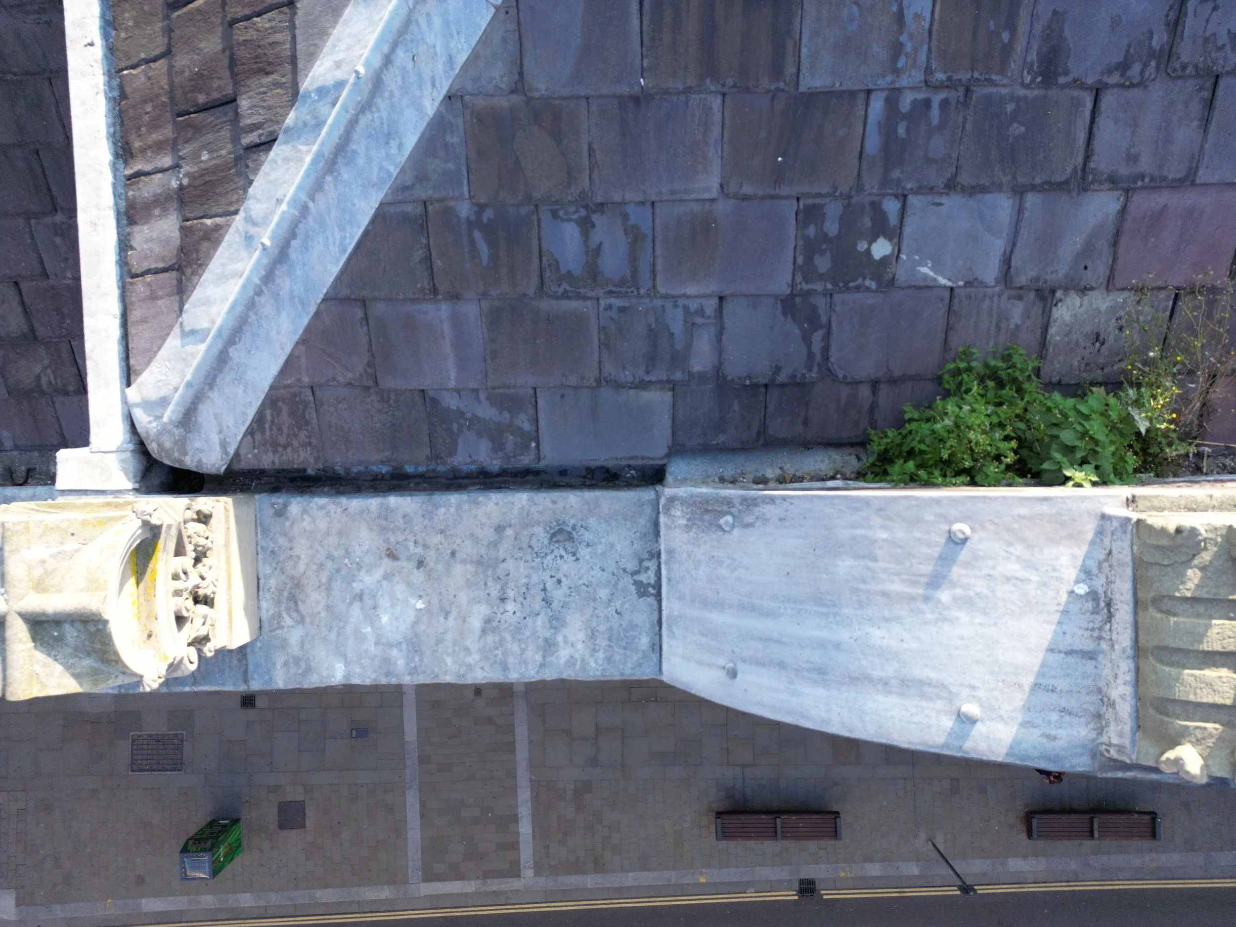
Facilities Management | Chartered Surveyors | Block Management
Challenge: Using traditional means to inspect roofs, façades, and difficult to reach areas on multi-storey buildings is costly, time consuming and potentially disruptive to residents and businesses.
Solution: Drone inspections deliver clear, accurate imagery allowing detailed condition reports, real time assessments, with minimal or no disruption, improved maintenance planning, and significant savings on access equipment and job hours. See our dedicated Commercial & Residential Inspection pages for more examples of common challenges faced and the solutions we provide.
CALL US FOR A CHAT ABOUT THE CHALLENGES YOU FACE AND THE SOLUTIONS WE CAN PROVIDE.
________________________________________________________________________________
Accredited with the CAA (Civil Aviation Authority) since August 2019.
Safety is of the utmost importance at Tailored Drone Solutions, detailed pre-flight planning and Risk Assessments are completed followed by a further on-site survey, all of which are underscored with robust Method Statements.
To further ensure every operation runs safely and efficiently the local Police, Air Traffic Control and other relevant authorities are made aware of the flight times and locations where necessary.
As a Professional Drone Operator, we are fully insured, holding an Insurance Policy which includes £5,000,000 of Public Liability cover which is is fully compliant with EU Regulation EC785/2004 - as legally required by the CAA.