
Construction
For Construction Professionals, integrating drone data into the workflow is a leap forward
Drone Data Solutions for Construction and Housebuilding Professionals
You’ve got tight budgets, tighter timelines, and a lot riding on accurate site information. We use regular aerial surveys creating maps and 3D site models to give you the information you need.
Your Challenges and Our Solutions:
Cost Uncertainty & Inflation Risk
Challenge: Inaccurate progress data leads to guesswork in forecasting and budgeting.
Solution: Real time objective aerial data gives a precise view of works complete, enabling teams with accurate valuations and cost control.
Dispute Resolution & Audit Trail
Challenge: Disagreements over scope or timelines can stall projects and damage relationships.
Solution: Clear, time stamped imagery provides an impartial record, robustly protecting your position and supporting your claims.
Site Oversight
Challenge: You cannot be everywhere at once.
Solution: Drone surveys let you accurately track progress of all sites from your desk, compare progress side by side, and focus your time where it matters most.
Late or Incomplete Design Information
Challenge: Drawings don’t always match reality, leading to costly reworks and delays.
Solution: Real time 3D models allow you to spot constraints early and align design intent with what’s actually on site.
Valuation & Payment Delays
Challenge: Slow site verification holds up approvals and cashflow.
Solution: Date stamped visuals give instant, indisputable proof of progress for faster sign off and drawdowns.
“Drone surveying has changed our working methods completely. It is efficient because it gives us accurate figures that let us make decisions without wasting time. The level of precision and timelines is out of this world.”
— John Smith, Construction Manager
If you face any of the challenges just call us for a chat, we will help you understand exactly how drone data will provide solutions on your project.
For some guidance regarding our competitive rates, see our pricing page. and contact us to chat about how we can help you.
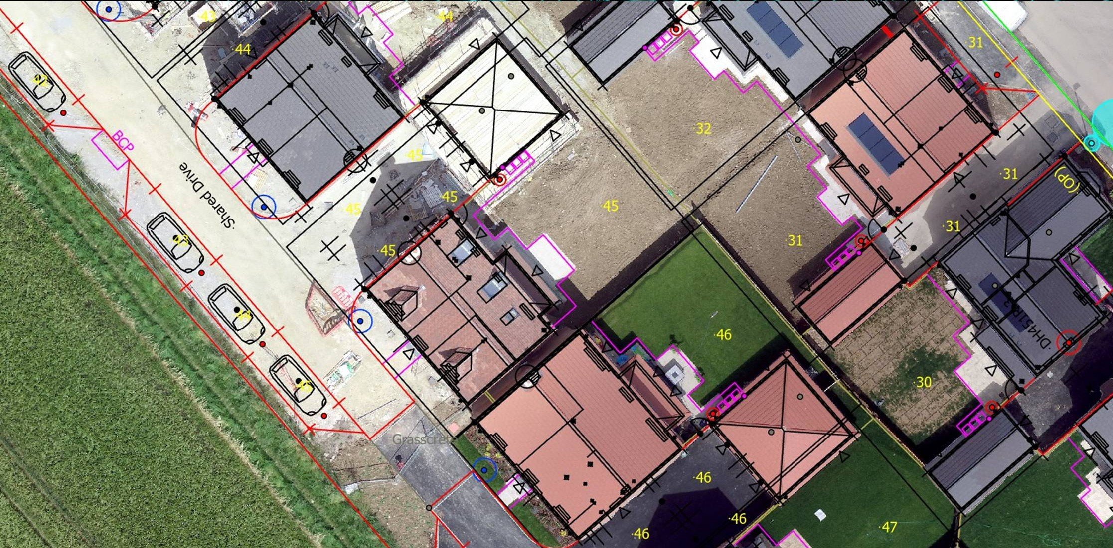
2D Orthomosaic Map overlay - early detection of discrepancies.
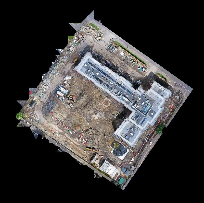
date stamped orthomosaic map of full site
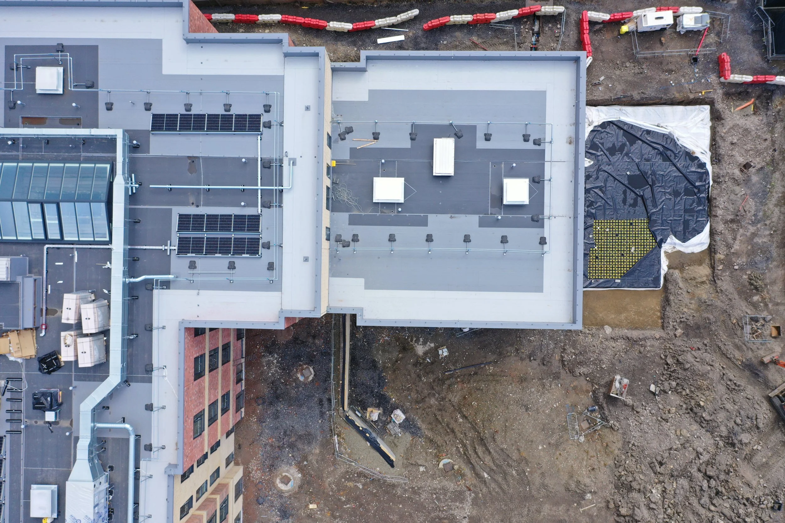
one of the 158 images used to create the date stamped orthomosaic